Threat In The Gulf: Hurricane Isaias (2026)
10/07/2026
Samuel Clifford
First Hurricane In Atlantic For 2026
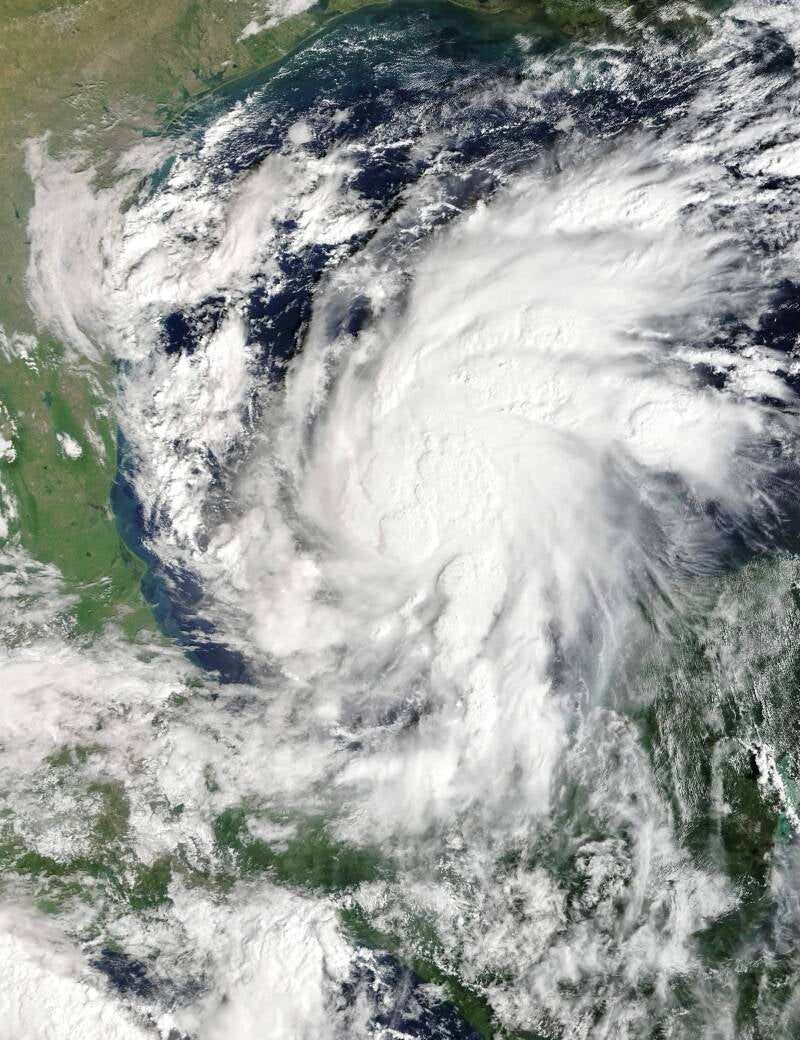
After the historic silence of hurricanes in the Atlantic Ocean, the first hurricane of the season is being projected to form in the Gulf of Mexico (America). Tropical Storm Isaias has formed in the warm waters near Mexico’s Yucatán Peninsula and is forecast to strengthen rapidly as it moves toward the northern Gulf Coast. Meteorologists forecast that this system will become the Atlantic season’s first hurricane, with the potential to reach major hurricane status before making landfall late Friday or early Saturday.
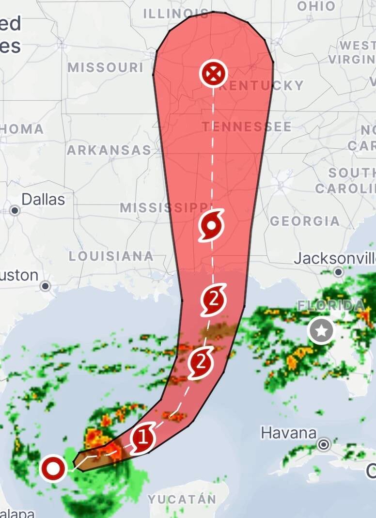
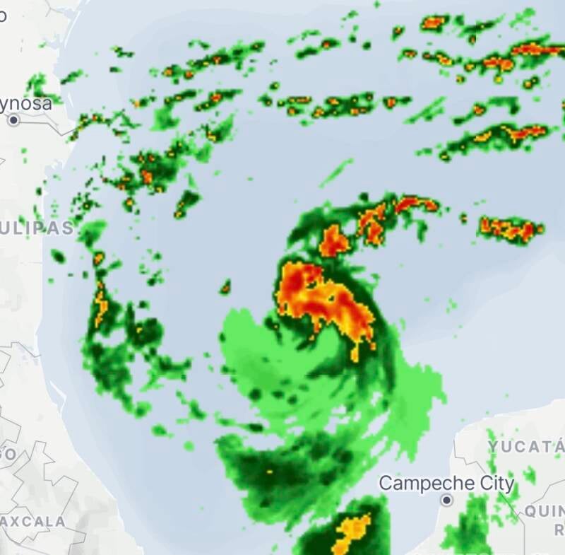
As of 3:25 pm EST the latest update is that Isaias is producing sustained winds of about 50 mph and is tracking east-northeast over the Gulf of Mexico. Forecasters believe the storm will curve northward and encounter favorable conditions for strengthening, including warm ocean temperatures that could fuel a period of rapid intensification.
Precautions Among The States
Residents and officials across the Gulf Coast are already taking precautionary measures as confidence grows in a significant storm event. The Governor of Florida, Ron DeSantis, has declared a state of emergency for 25 counties across the Florida Panhandle and Big Bend regions, allowing emergency resources and personnel to be deployed ahead of the storm. The following counties are under a state of emergency:
Baker, Bay, Calhoun, Columbia, Dixie, Escambia, Franklin, Gadsden, Gilchrist, Gulf, Hamilton, Holmes, Jackson, Jefferson, Lafayette, Leon, Liberty, Madison, Okaloosa, Santa Rosa, Suwannee, Taylor, Walton, Wakulla, and Washington counties.
Local governments are encouraging residents to review emergency plans, stock supplies, and prepare for possible flooding and power outages. In Pensacola, utility crews have been placed on standby, while city officials have distributed sandbags to help protect homes and businesses from rising water.
The National Hurricane Center has issued hurricane watches along portions of the northern Gulf Coast, stretching from Mississippi into the Florida Panhandle. Hurricane conditions could develop within the next 48 hours if the storm continues on its projected track. While forecasters have narrowed the likely landfall zone to an area between the Mississippi coastline and the western Florida Panhandle, uncertainty remains regarding the exact location and strength of the storm when it reaches shore.

Heavy rainfall is expected to be one of Isaias’ most widespread hazards. Coastal areas from southeastern Louisiana to the Florida Panhandle could receive 3 to 6 inches of rain, with isolated locations potentially seeing up to 10 inches. Additional rainfall may extend inland across parts of Alabama, Tennessee, and the Carolinas. Flash flooding is possible in areas that experience the heaviest rain bands, particularly across southern Alabama and the western Florida Panhandle.
Furthermore, storm surge also poses a significant threat. Coastal communities from eastern Mississippi through Alabama and into the western Florida Panhandle could experience water levels 5 to 7 feet above normally dry ground if peak surge coincides with high tide. Such conditions could inundate roads, damage structures, and create dangerous travel conditions.
As Isaias grows in size and intensity, strong winds are expected to spread across a broad portion of the Southeast. Tropical storm-force winds could begin reaching the coast as early as Friday, with hurricane-force winds possible near the eventual landfall location. These winds could topple trees, damage buildings, and cause widespread power outages extending well inland from the coast. Forecasters are also monitoring the possibility of tornadoes developing within the storm’s outer rain bands, particularly on the eastern side of the system. The tornado threat may increase Friday night and continue into Saturday across portions of Alabama and neighboring states.