Cyclone Off Solomon Islands, Heading to Queensland (March 16, 2026)
03/16/2026
Samuel Clifford
A developing tropical weather system near the Solomon Islands is raising concern among meteorologists across the South Pacific. The disturbance, currently identified as a tropical low south of the Solomon Islands in the Coral Sea, has shown signs of strengthening and may develop into a tropical cyclone within the coming days. Weather agencies report that warm ocean temperatures and relatively low wind shear are creating favorable conditions for intensification, allowing the storm to organize more clearly as it moves westward. Forecast models indicate winds of roughly 45–55 km/h around parts of the circulation, with further strengthening possible as the system tracks across open water.
The system is currently positioned south of the Solomon Islands and is expected to move toward the far-northern coast of Queensland, Australia, later in the week. Meteorologists warn that it could become a strong or even severe tropical cyclone, potentially reaching Category 4 intensity or even Catergoty 5 if environmental conditions remain. Authorities in northern Australia have already issued alerts and are monitoring the storm closely, as heavy rain and strong winds may accompany the system if it continues to strengthen. Flood-prone areas in the region are particularly vulnerable due to recent rainfall and saturated ground conditions.
Although the storm has not yet reached full cyclone status, its development highlights the vulnerability of Pacific island nations and nearby coastal regions during the South Pacific cyclone season. Systems in this region can intensify rapidly, bringing destructive winds, heavy rainfall, and coastal flooding. Governments and weather agencies are urging residents in affected areas, including the Solomon Islands and northern Australia, to monitor forecasts and prepare for possible severe weather impacts over the next several days as the tropical low evolves.
Sourcez
Masters, Rebecca. “Flood-weary Far North Queensland on Cyclone Watch.” 9News, 16 Mar. 2026.
“Queensland Weather: Tropical Low Could Develop into Cyclone.” 9News, 17 Mar. 2026.
“Cyclone Watch Issued as Tropical Low Strengthens off Far North Queensland.” ABC News Australia, 17 Mar. 2026.
“Cyclone Forecast to Cross Far North Queensland Coast within Days.” News.com.au, 17 Mar. 2026.
“Invest 96P (Tropical Low 34U) Tracker and Forecast.” Zoom Earth, 2026.
“7-Day Tropical Cyclone Forecast.” Australian Bureau of Meteorology, 2026.

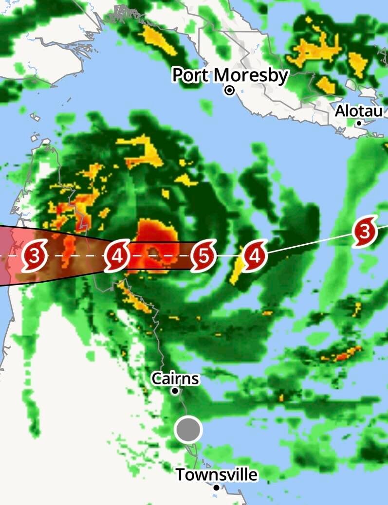
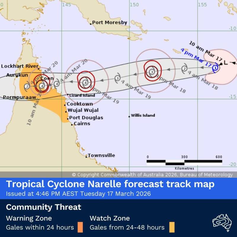
March 17, 2026 (7:05 am EST) Update:
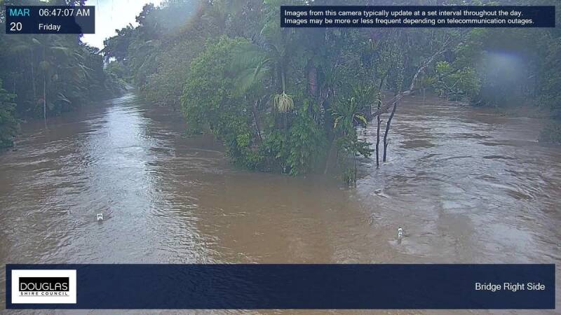
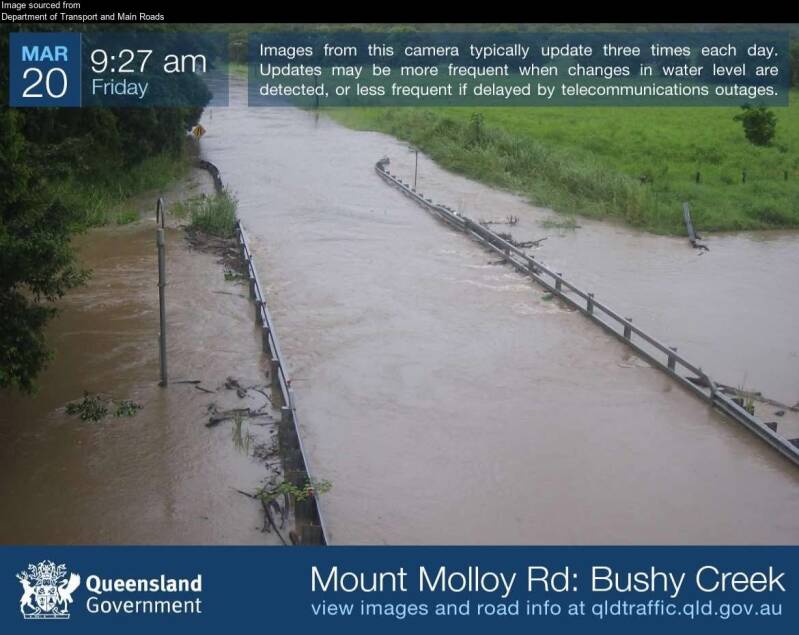
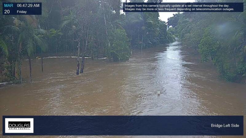
Tropical Cyclone Narelle (34U) has intensified into a tropical cyclone over the northern Coral Sea. Now a Category 1 system, Narelle is forecast to continue tracking westward and approach the far northeast Queensland coast, with the zone of concern stretching from Lockhart River to Port Douglas. It is likely going to his Northern Queensland as a Category 4 or possible even 5 in the early mornings of Friday, March 20, 2026.
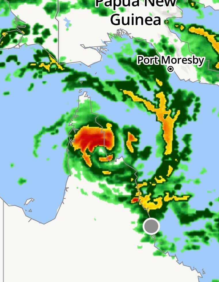
March 18, 2026 Images Below:


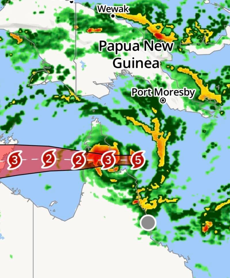
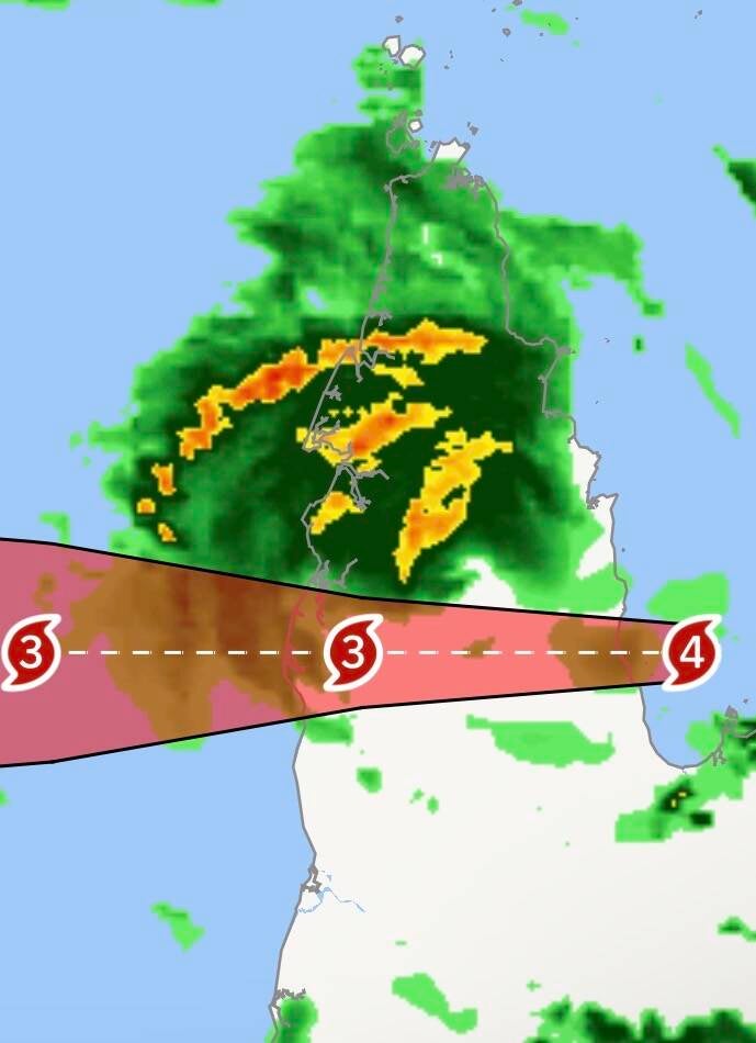
March 19, 2026, Images and Videos:
I know some images will say March 20, 2026, but that is simply because the images were taken in Australia and it was March 20th there, but still March 19 where I am located.